
Custom 3D Topo Maps Inspired by NH Hiking Trails
For years, I’ve had this idea living in the back of my mind: a way to capture the feeling of standing on a New Hampshire summit and bring it into physical form. Not just a flat map, not just wall art—but a 3D topographical map that shows the real rise and fall of the terrain and highlights the hiking trails that make New Hampshire’s mountains so memorable.
I’m excited to finally share the result: custom 3D printed topographical maps of New Hampshire mountains, designed specifically for hikers, outdoor enthusiasts, and trail lovers.
Inspired by New Hampshire’s Hiking Trails
Anyone who hikes in New Hampshire knows these mountains have personality. From steady climbs to rocky scrambles and exposed ledges, every trail tells its own story. I wanted these topo maps to reflect that experience as accurately as possible.
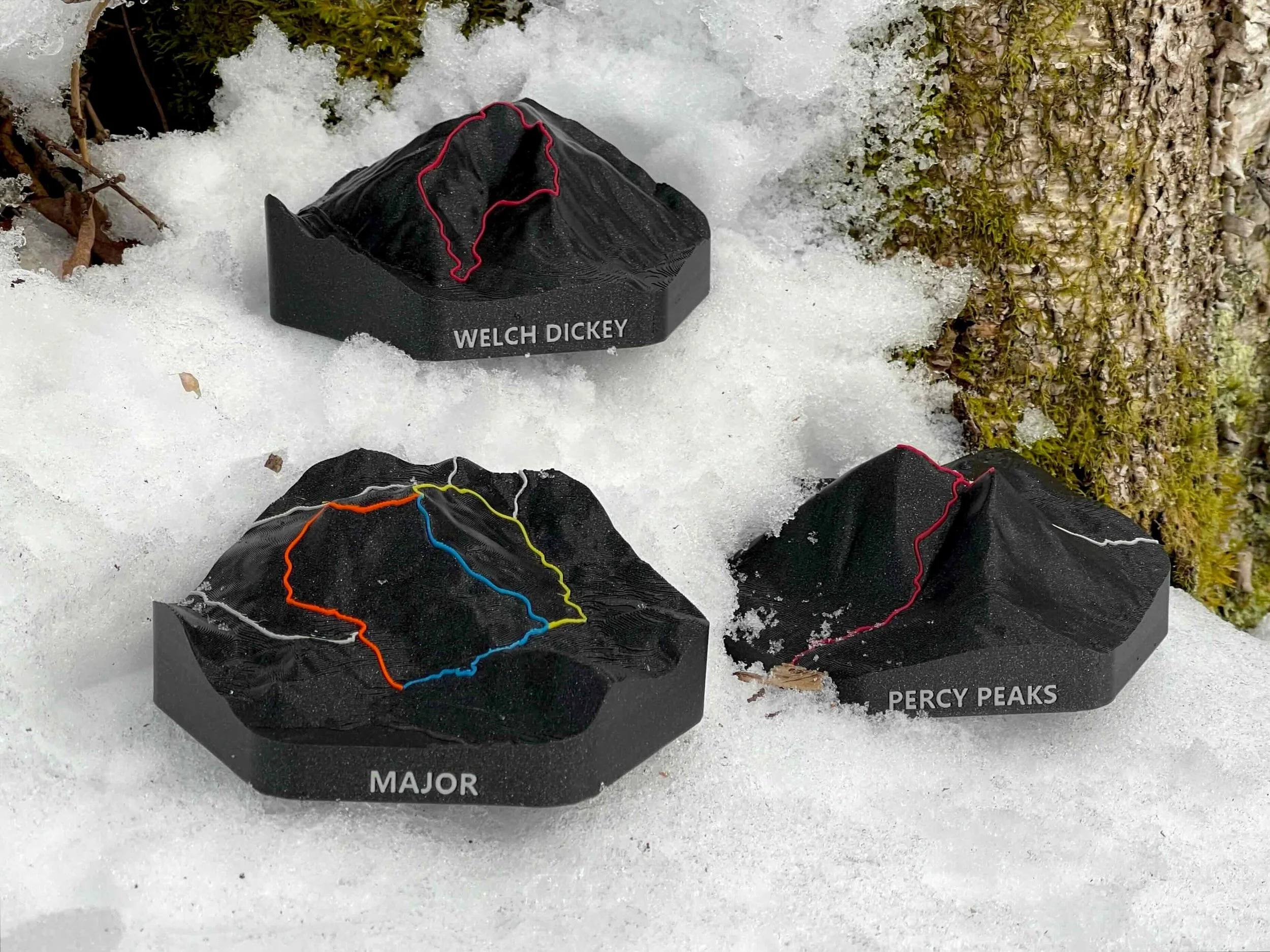
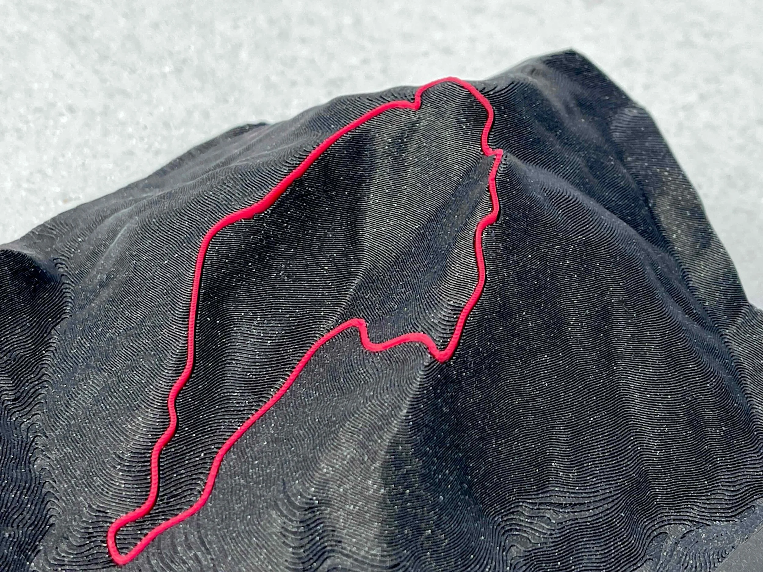
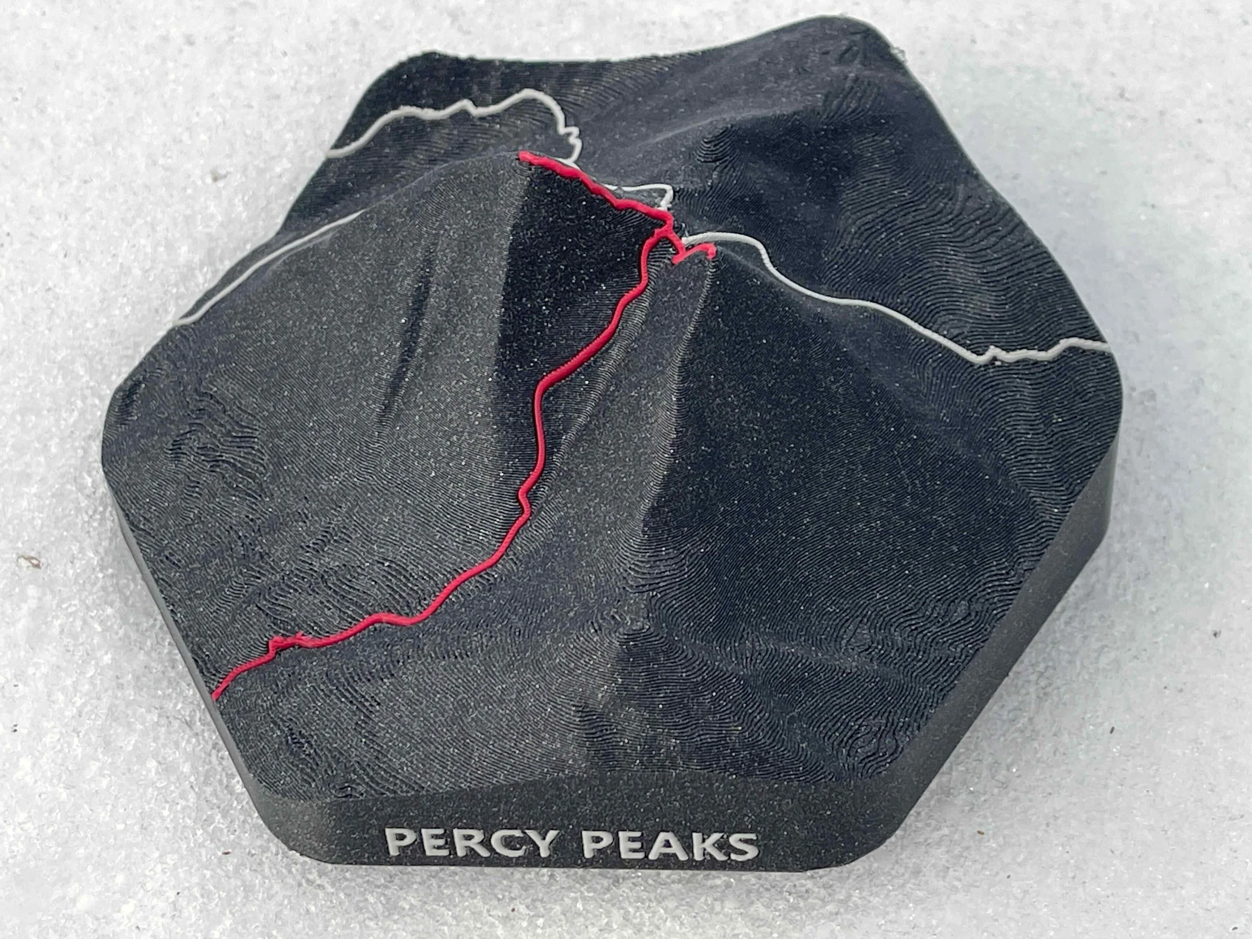
I create each map using real elevation data and carefully scaled to emphasize the terrain. Hiking trails are then highlighted in bright, contrasting colors, making them easy to follow across ridgelines and up summits. The first three maps in this series feature Mount Major, Percy Peaks, and the classic Welch–Dickey Loop—each chosen for its unique landscape and popularity among NH hikers.
From Long-Held Idea to Finished Topo Map
This project has been years in the making. I always envisioned creating something physical that blended my love of hiking with 3D printing, but getting it right took time.
There was a lot of experimentation—fine-tuning elevation detail, testing print materials, and adjusting trail visibility so the maps feel both informative and visually striking. Seeing the first successful print come together felt like reaching a summit after a tough climb: satisfying, earned, and absolutely worth it.
Designed for Hikers and Outdoor Enthusiasts
These aren’t generic New Hampshire maps. Each piece is custom made, focused on a specific mountain and trail system that hikers actually know and love.
They’re perfect for:
Remembering a favorite New Hampshire hike
Commemorating a first summit or personal milestone
Gifting to a hiking partner or outdoor enthusiast
Displaying as meaningful trail-inspired wall art
Bringing New Hampshire’s Mountains Indoors
My goal with these 3D topographical maps of New Hampshire hiking trails is to help keep a connection to the mountains alive, even when you’re not out on the trail. I’m starting this series with Mount Major, Percy Peaks, and the Welch–Dickey Loop, three hikes that showcase just how diverse and rewarding NH terrain can be. This is only the beginning—I’m excited to continue expanding the collection and introducing more New Hampshire mountains and trails over time. Check them out at bellair3d.com/store