Franconia Ridge 3D Topo Map: A Stunning View of One of NH’s Most Iconic Hikes
If you’ve ever hiked Franconia Ridge in New Hampshire, you know it’s one of the most breathtaking alpine traverses in the Northeast. Now imagine capturing that entire ridgeline—not in a photo, but as a detailed 3D printed topographic map you can hold in your hands.
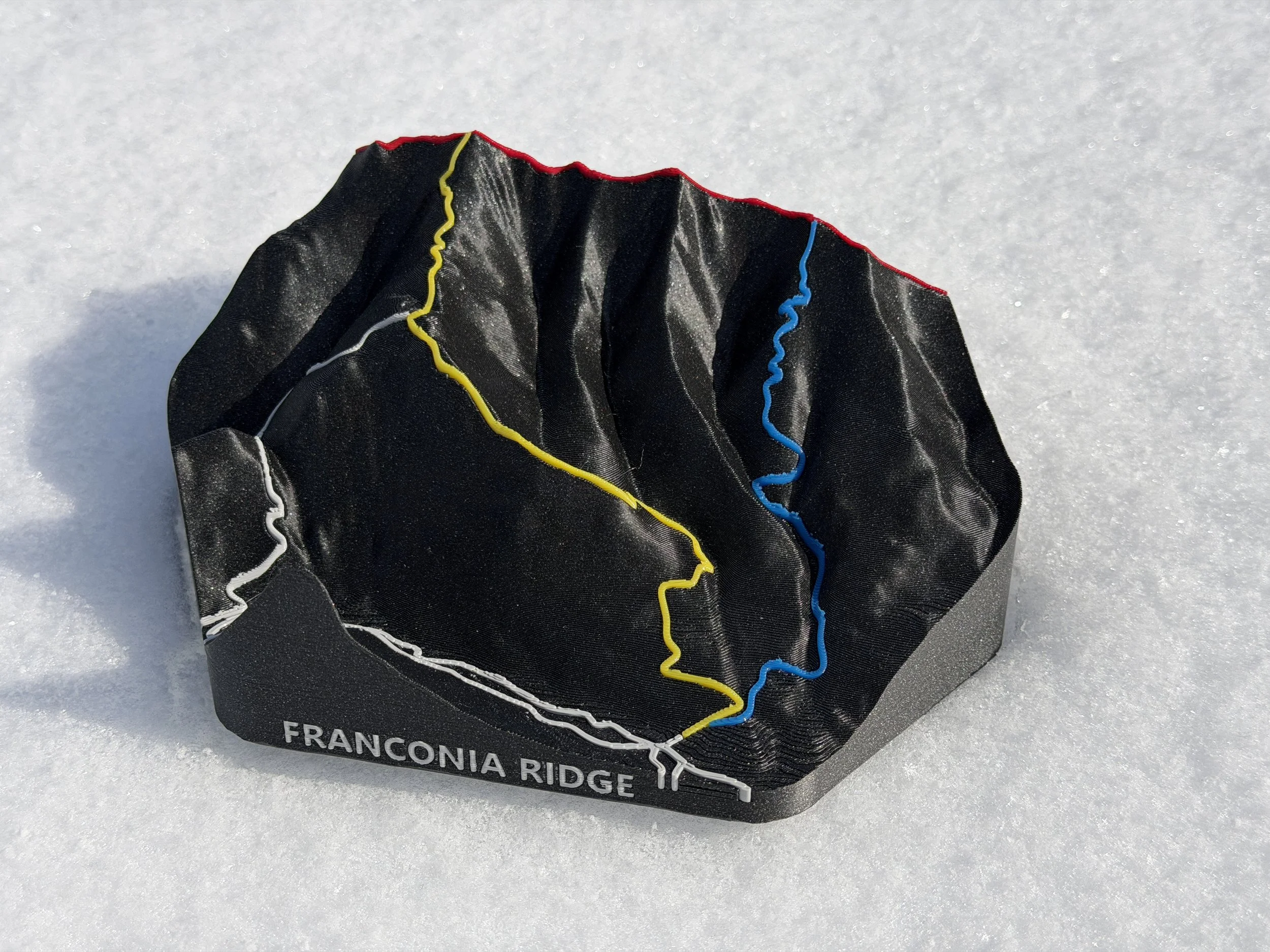
The Franconia Ridge 3D topo map from Bellair3D does exactly that. It transforms one of the White Mountains’ most famous hikes into a tactile, display-worthy piece that blends outdoor adventure with modern 3D printing technology.
What Is a 3D Topographic Map?
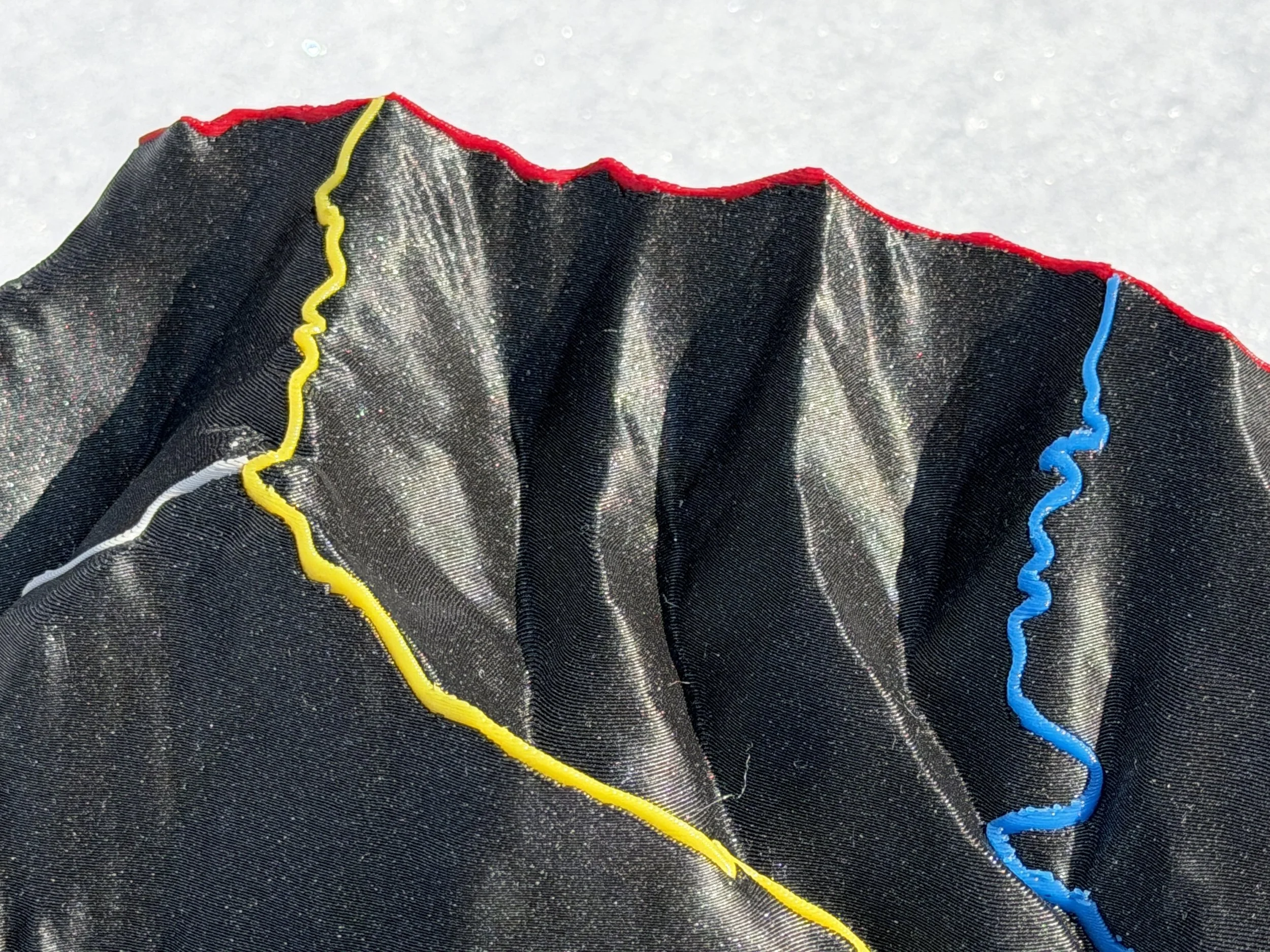
A 3D topographic map is a physical model that represents terrain elevation using real geographic data. Instead of flat contour lines, elevation changes are expressed as actual height differences—making mountains, ridges, and valleys immediately understandable. Bellair3D uses 3D CAD to recreate the map in 3D and then 3D printing to build the the physical model. The result is a model that’s both accurate and visually striking.
Why Franconia Ridge Is Perfect for a 3D Printed Map
The Franconia Ridge Loop is one of the most popular hikes in New Hampshire’s White Mountains—and for good reason. It features:
A dramatic, exposed ridgeline
Peaks like Mount Lafayette and Mount Lincoln
Panoramic alpine views above treeline
Steep elevation changes and rugged terrain
These characteristics make it ideal for a 3D terrain model, where elevation and shape are the main focus.
On a traditional map, these features are abstract. On a 3D printed topo map, they come to life.
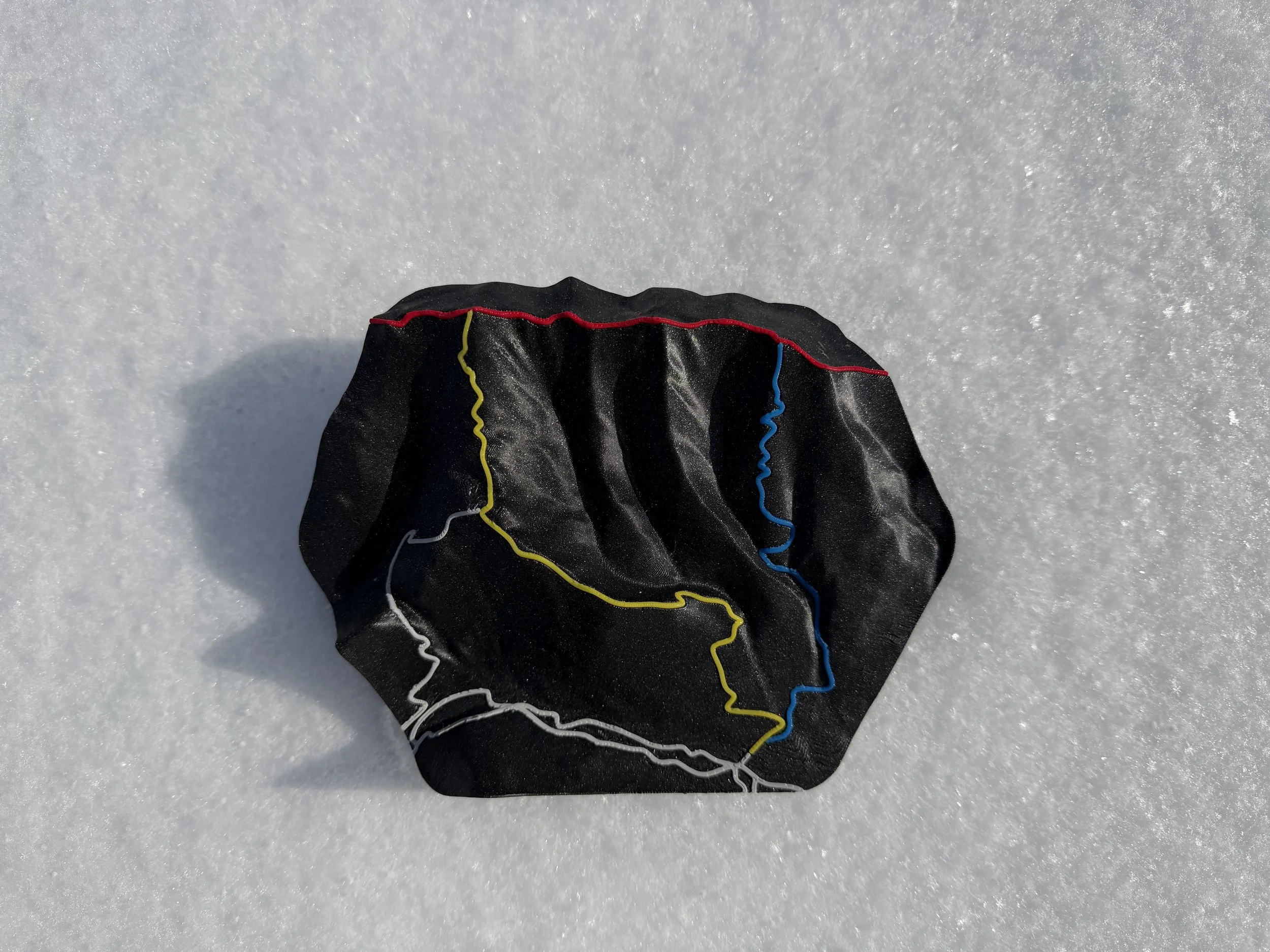
Features of the Franconia Ridge 3D Topo Map
The Bellair3D model captures the essence of the ridge in a clean, display-ready format. Key highlights include:
Accurate elevation representation
Clearly defined ridgeline geometry
Compact, desk-friendly size
Minimalist aesthetic for home or office display
Vibrant colors to individually identify trails
This makes it appealing not just for hikers, but also for engineers, designers, and anyone interested in terrain modeling.
Why You Need This Map
This type of 3D printed map is perfect for:
Hikers who have completed the Franconia Ridge Loop
White Mountains enthusiasts
3D printing and engineering fans
Anyone looking for unique New Hampshire decor
It’s especially meaningful if you’ve personally experienced the ridge—it becomes a physical reminder of the hike.
Final Thoughts: A New Way to Experience the White Mountains
The Franconia Ridge 3D topographic map is more than just a model—it’s a new way to experience and appreciate the terrain. Bellair3D has created this map with hikers in mind.
By combining real-world elevation data with modern 3D printing, it transforms one of New England’s most iconic hikes into something tangible. Whether you’re reliving a hike or discovering the ridge for the first time, this piece offers a perspective that flat maps simply can’t match.